Light and Weather
Reading haar on the Fife coast the night before
The North Sea fog that fills the east coast harbours between spring and late summer is not random. It follows sea surface temperature and an onshore wind with a light gradient, and both are published the evening before.
Published 18 August 2026 East Neuk of Fife Field entry
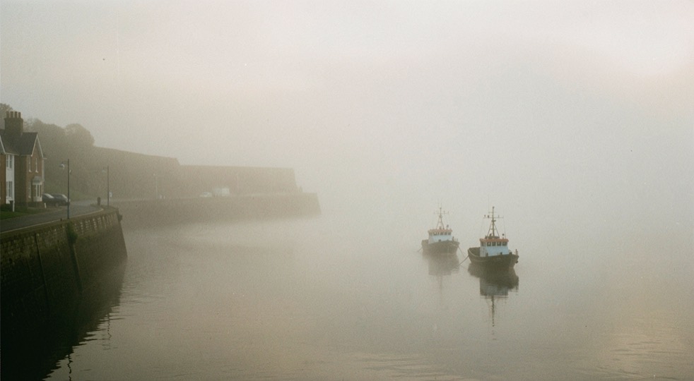
Haar is the east coast name for sea fog, and along the Fife coast it is the most useful weather of the year. It removes everything beyond about two hundred metres, which turns a working harbour into three objects and a wall, and it does it under a light so even that the whole scene sits within a stop. The reason it is worth a whole entry is that, unlike almost every other photographic condition in Britain, it can be predicted with reasonable confidence the evening before.
The mechanism, which is not radiation fog
Valley fog forms because the ground cools at night and chills the air lying on it. Haar does not work that way at all. It is advection fog: air that is already warm and moist is carried horizontally over a sea that is colder than its dew point, and the water vapour in it condenses in the lowest few hundred metres. The sea does the cooling, and the sea does not warm up overnight, which is why haar can persist for days when radiation fog burns off by nine in the morning.
That gives you the forecast in a single comparison. Take the dew point of the air over the North Sea and take the sea surface temperature. If the dew point is above the sea temperature, the air will be cooled below its own saturation point as it crosses the water, and fog will form. In May the North Sea off Fife is somewhere around eight to ten degrees, while a plume of warm continental air can easily carry a dew point in the low teens; that gap is the whole phenomenon.
It follows that the season runs from roughly April to August, and peaks in late spring and early summer when the contrast between a warming land mass and a still cold sea is at its widest. By October the sea has caught up and the haar largely stops.
The three things to check the evening before
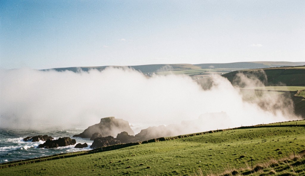
First, wind direction. Haar needs an onshore component, which on this coast means anything from north east through east to south east. A westerly holds it offshore no matter how thick it is out there, and you can spend a beautiful clear day watching a white wall sitting three miles out.
Second, wind strength. This is the part most people get wrong. A dead calm is not what you want, because the fog then sits over the water and never comes in. A gale mixes the layer out and destroys it. What carries haar ashore and keeps it there is a light to moderate gradient, roughly force two to four, enough to move the air mass without stirring it.
Third, the visible satellite imagery from the previous afternoon. Sea fog shows on it as a smooth, flat, brilliant white sheet with a sharply defined edge, quite unlike the textured tops of cumulus, and it usually sits there for hours before it moves. If the sheet is already lying off the Firth of Forth at six in the evening with an easterly forecast overnight, the odds are good. National forecast output and coastal station observations, both of which are published by the national weather service, will give you visibility and dew point at the nearest coastal stations to confirm it.
On the ground
Haar is cold and wet in a way that a temperature reading does not convey. It condenses on the front element continuously rather than occasionally, so the working habit is a cloth in the hand rather than in the bag, and a check of the glass before every frame instead of every tenth.
It also strips contrast out of the autofocus system. On a harbour wall dissolving into white there may be nothing for the camera to lock onto; focusing manually on the nearest hard edge, usually a mooring ring or a bollard within a few metres, is faster than fighting it.
Where to be, and at what hour
The East Neuk harbours are the obvious ground and they earn it. Crail, Anstruther, Pittenweem, St Monans and Elie all sit within a few miles of each other on the south facing Fife shore, so a single morning can take in more than one, and each has a harbour wall, a set of steps and a group of small boats, which in fog is a complete subject.
Timing is different from most landscape work. Haar does not need sunrise; it needs enough light to see by, and it is often at its best an hour or two after dawn when there is enough sun above to put a diffuse glow into the top of the fog without burning it off. The bank also tends to thin and thicken in waves as it drifts, so a spot that is useless at seven can be perfect at half past. This is one of the few conditions where waiting in one place beats driving between three.
Exposure needs a deliberate hand. A frame that is nine tenths white fog will be dragged toward mid grey by any meter left to itself, and the result is a dull, muddy picture of what was a luminous scene. Adding a stop or more of exposure and watching the histogram against the right hand edge is the whole technique.
What haar does to composition
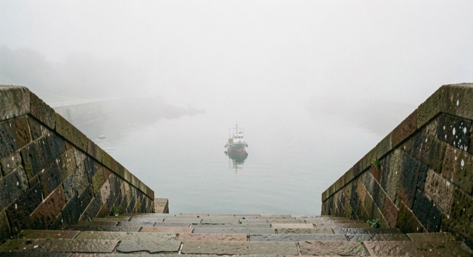
Fog is a depth cue machine. Because contrast falls off with distance, objects separate into clear planes: a black bollard at two metres, a boat at fifteen, a wall at eighty, nothing beyond. That is a gift, because it does the layering for you and it removes every distraction on the horizon. It also means the picture has to be built close, since anything more than a couple of hundred metres away has stopped existing.
The failure mode is emptiness. A picture of fog with nothing in it is a grey rectangle, and the discipline is to insist on one hard, dark, unambiguous shape in the near frame to anchor everything else. A single mooring post will do it. Two boats will do it. A wall running out of the frame into white will do it, because the eye follows it and is stopped.
The same North Sea mechanism reaches down the English coast, where it is called a sea fret in Yorkshire and Northumberland, and it lands on the Norfolk marshes under much the same conditions; what it does to that flatter ground is described in the entry on photographing the saltmarsh at Blakeney. For the names of the other conditions that turn up in these entries, from gloaming to Brocken spectre, there is a glossary of British light.
And when the haar refuses to come ashore, the fallback is often a flat overcast day, which is a great deal more useful than its reputation suggests: the entry on anticyclonic gloom sets out what to point it at.