Coast and Estuary
Saltmarsh at Blakeney, ground that is mostly water
A marsh has no landmarks and no reliable edges, which makes composition difficult and navigation considerably worse. Using the creeks themselves as the structure of the frame.
Published 14 April 2026 Blakeney and Morston, north Norfolk Field entry
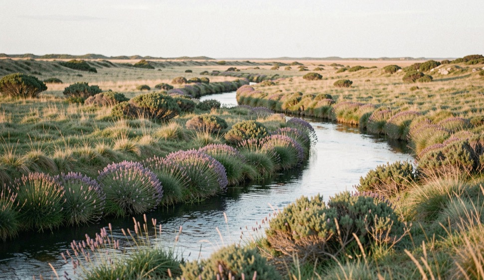
The north Norfolk marshes are the least dramatic landscape in this journal and one of the hardest to photograph well. There is no relief, no rock, and no horizon worth the name: a plain of samphire and sea lavender lying a metre or so above chart datum, cut through by creeks that wander, and closed on the seaward side by the shingle of Blakeney Point. Everything that gives a picture here its structure is either water or the channel that water made.
The creeks are the composition
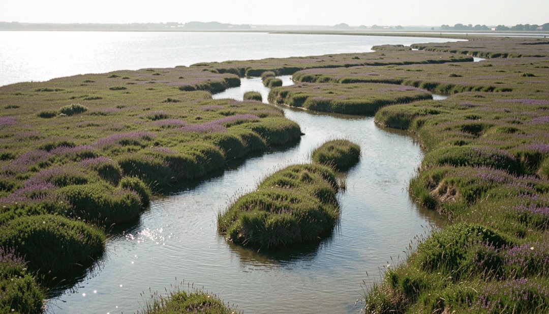
A saltmarsh drains through a branching network, and that network is the only line the place offers. It behaves exactly like a river seen from the air: a main channel, tributaries entering at shallow angles, meanders that tighten as the ground flattens. Photographed from marsh level the creeks are invisible, because the banks are higher than the water. Photographed from a metre or two above them, from the sea wall between Cley and Blakeney or from the quay at Morston, they resolve into a legible pattern.
The state of the tide decides whether that pattern reads at all. An empty creek at low water is a groove of grey mud, the same tone as the marsh either side of it, and it disappears. A creek filling on the flood is a bright line of moving water that separates cleanly from the vegetation and carries the eye. On this coast that is the whole game: the picture wants the first two hours of the flood, with the light low.
Blakeney church helps more than it should. St Nicholas has two towers, the second and much smaller one at the east end, and from several points on the marsh that odd double outline sits on the skyline and gives the frame something to end on. It is one of the few fixed marks in a landscape that otherwise offers none.
The tide gets behind you here
A marsh floods through its creeks first and over its surface last. That is the hazard in one sentence. The ground you walked out on can still be dry while the channel between you and the shore is already too deep to cross, and on a high spring tide, especially with a north or north west wind pushing water into the bight, the whole marsh can go under. There is no swimming out of a saltmarsh creek: the banks are soft mud and vertical.
The working rule is to be off the outer marsh before the tide table shows two hours to high water, and to know which creek lies between you and the path before you cross it. Local advice on this coast is neither superstition nor sales talk; the marshes at Stiffkey and Morston catch people every year. If a picture needs the last half hour of the flood, it is made from the sea wall.
On the ground
Marsh mud is fine, sticky and deep at the creek edges, and it will take a boot off. Walk on the vegetated surface rather than the bare mud, cross creeks at the shallow shoulder of a bend rather than the outside where the water has cut, and accept that the shortest line back is usually the wettest.
This is a national nature reserve with breeding and wintering birds on it in large numbers. Seal watching boats run from Morston quay and the point itself has seasonal restrictions. The marsh is worth photographing precisely because it is busy with wildlife, which is a reason to stay on the paths rather than an excuse to leave them.
Colour, and the fortnight it lasts
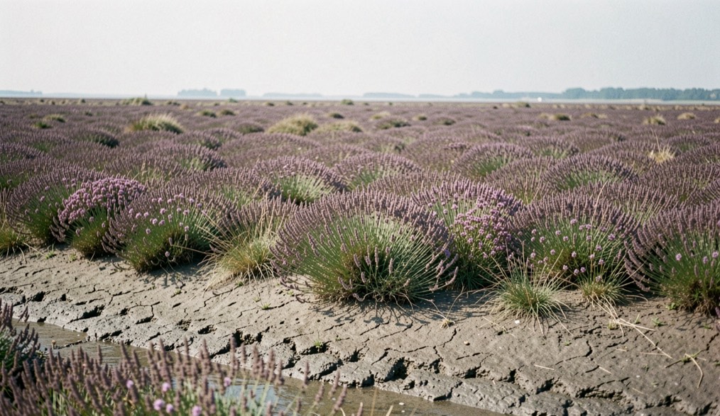
For most of the year the marsh is olive, straw and grey. Then in high summer the sea lavender comes out across the middle marsh and the ground turns a dusty violet for a couple of weeks, usually in the second half of July. It is a genuine change of subject rather than a change of hue: the flowering zone follows a particular height above the tide, so the colour arrives as a broad band that follows the contour of the marsh and shows exactly where the ground sits relative to mean high water.
Samphire does something similar in reverse. It grows lower down, on the bare mud beside the creeks, green through the summer and turning rust and orange from September, which gives a marsh photographed in October two clearly separated bands of colour where a marsh in June has one. Keeping a note of those dates year on year is the only way to stop guessing, which is the same discipline applied to the moor in the entry on how unevenly heather flowers from one end of a moor to the other.
Weather that suits flat ground
Marshes do not need dramatic light and are usually ruined by it. A hard low sun turns the vegetation into a mass of small shadows and the creeks into blown highlights. The conditions that suit this ground are the ones most people go home from: high thin cloud, a sea fret coming in off the North Sea, or the even grey of a stationary front. Under flat light the marsh reads as tone and shape, which is what it actually is, and the creeks keep their separation without fighting the sky. The argument for working in that light rather than driving home is made at length in the entry on flat grey days.
The one exception is fog, which on this coast can be spectacular and is worth a wasted journey. It removes the far shore, leaves the nearest creek and its bank as the only things with edges, and turns a landscape with no depth into one made entirely of depth. That is the same North Sea mechanism described on the Scottish side in the entry on forecasting haar the night before, and it reaches Norfolk under much the same conditions.
The saltmarsh at Blakeney is ground that is mostly water, and the birds that use it are read at distance, through glass, by silhouette and call. On foot the method changes. Tracks in mud, droppings, burrows and scratch marks carry the same information at close range, and they reward the same patience the tide here demands. A short guide to wombat burrows and koala signs sets out how to identify what has passed, which calls belong to which bird, and how colour separates one parrot from another. It is written for walkers who want to know what they are looking at, not only what they are looking for.