Coast and Estuary
Low water on the Solway, and the tide table as a schedule
On a firth this shallow the water leaves faster than you can walk across the flats it uncovers. An account of which hour of the ebb gives you the channels, and which one strands you.
Published 28 June 2026 Solway Firth, Cumbria Field entry
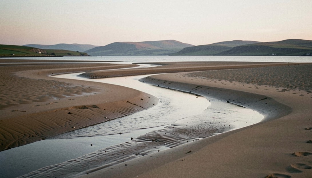
The Solway is not a coast in the way that Cornwall is a coast. It is a shallow trough of sand between Cumbria and Dumfries and Galloway, filled and emptied twice a day, and for several hours out of every twelve there is almost no sea in it at all. What is left behind is the subject: a plain of ridged wet sand cut by draining channels, running out toward the Galloway hills with Criffel sitting above the far shore. It photographs like a river delta and behaves like one, which is to say the shape of it is different every month.
The English shore faces the sunset
This matters more than any other single fact about the location. The Cumbrian coast from Maryport up through Allonby, Silloth and Skinburness looks roughly west and north west across open water, which makes it one of the few stretches of English coastline where the sun genuinely sets into the sea rather than behind a town. From late spring to midsummer the sun goes down well north of west, out over the mouth of the firth; by November it has swung round to set across the Scottish shore instead, and the light comes in flat along the sand rather than down it.
The consequence for planning is simple. In June the useful frame is the one pointing out to the open west, with the channels running away from the camera into the glare. In January the useful frame is the one pointing north west across the flats, with the low sun coming from the left and raking every ridge of sand into relief. Same beach, two entirely different pictures, and both depend on being there while the water is out.
Which hour of the ebb
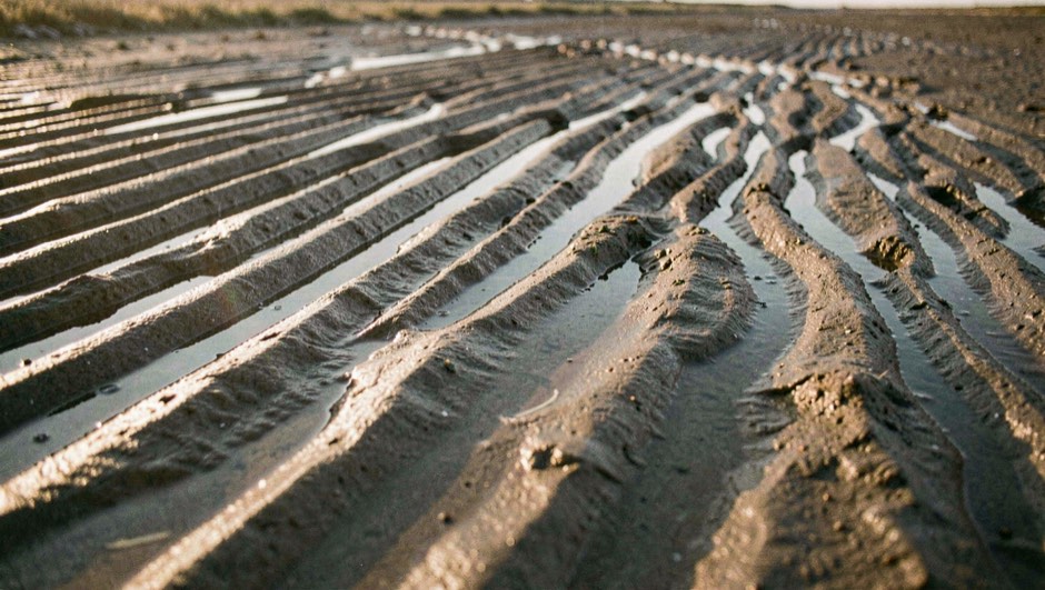
High water is useless here and dead low water is nearly as bad. At the top of the tide the flats are covered and the shore is a plain grey line; at the very bottom the sand has been draining for six hours, the channels have emptied, and the whole plain goes matt. The hour worth having is the third and fourth hour after high water, when the water is falling fastest and the channels are still full and moving.
That is not a habit, it is arithmetic. Under the rule of twelfths a semi diurnal tide drops about a quarter of its range in the third hour alone, and on a spring tide at Silloth the range can run to something close to eight metres. Divide that over roughly six hours and the middle of the ebb is doing several times the work of the first hour. The channels are therefore at their most defined, the sand is still wet enough to be dark and reflective, and there is a visible current in the frame instead of a puddle. The mechanics of reading that off a printed table, including the difference between a standard port and the secondary port you are actually standing at, are set out in the entry on how to use a tide table as a working schedule.
On the ground
The Solway flats include soft ground and channels that refill from the seaward side, which means the water can come round behind you while you are still walking out. Fix a bearing back to a fixed object on shore before you leave the top of the beach, and treat any patch of sand that trembles under weight as a place to walk away from rather than test.
The firth is also a military and wildfowling landscape in places, and much of it is a designated bird site. In winter the flocks on these flats are the point of the place; walking straight into them empties the frame and wastes their daylight as well as yours.
Composing on ground with no vertical
The difficulty on an estuary this wide is that everything is horizontal. Sand, water, far shore, cloud: four bands stacked one on another, and no upright anything to break them. There are three ways out of it, and they all work here.
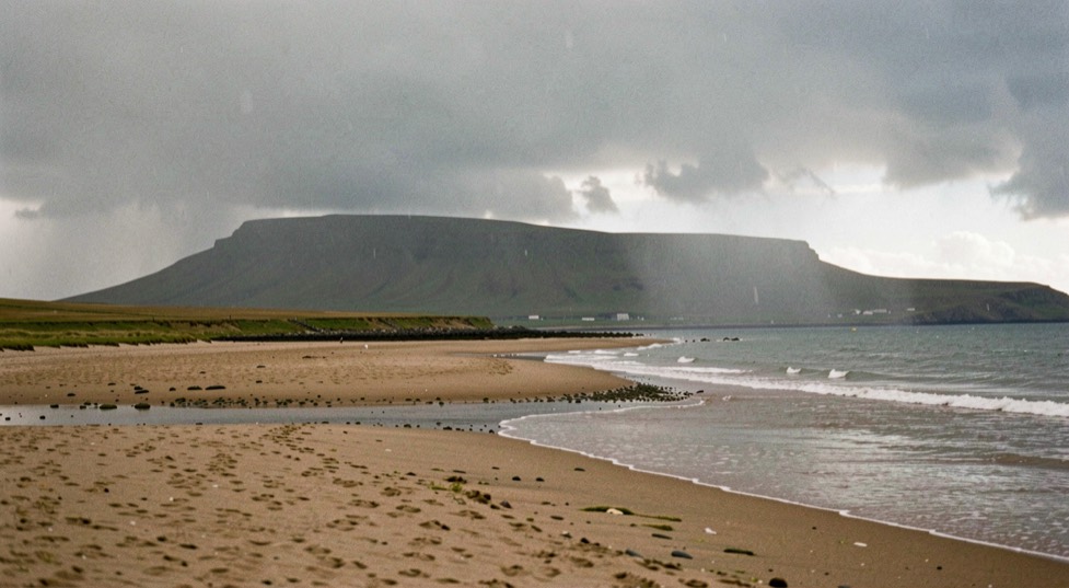
The first is to use a channel as a diagonal, standing close to its edge so that it enters the frame in a bottom corner and leads out toward Criffel. The second is to get low enough that the ridges of sand in the near foreground become the largest objects in the picture, which puts a texture under the eye before it travels. The third is to wait for the sky to supply the vertical: a shower running down the firth gives you a curtain of rain that stands upright in the frame and dates the picture to the minute.
What does not work is standing on the sea wall at Silloth and photographing the view. It is a fine view and a flat photograph, because from up there the channels compress into a pattern with no depth in them. The picture is made from the sand, not from the promenade above it.
What the ground does to equipment
Wet sand at this state of tide is close to liquid a few centimetres down. A tripod planted on it will sink slowly and unevenly for as long as it stands there, and a two minute exposure is quite long enough for the horizon to tilt out of true. The remedy is the same one used on peat and on scree, which is to set each leg, weight it, lift it, and set it again into its own compacted hollow, then check the frame rather than the bubble. That method and the reasons behind it are given in full in the note on levelling a tripod on ground that moves.
The other tax is salt. Even on a still day there is a film of it on everything within an hour, and it dries invisible on a front element. The habit worth building is to check the glass against the sky between frames rather than at the car, because a marked filter costs nothing to wipe on the beach and costs a whole session if it is found at home.
Where the Solway sits in the wider ground
This firth is the northern edge of the country covered by the first archive set, and several of its plates were made within a few miles of here, between the Cumbrian shore and the Border hills behind it. Those are catalogued in British Landscapes 1, the Lakes and Borders set, which gives the conditions recorded on each one.
For a comparable but softer version of the same problem, the Norfolk marshes work on the same tidal clock with far less exposed distance and far more structure underfoot; the entry on photographing saltmarsh at Blakeney covers what changes when the creeks are cut into vegetation instead of open sand.
The Solway timetable rewards patience, but the same discipline applies to rivers where the water is fresh rather than tidal. On the River Moy, the window is set by the run of fish and the height of the water, not by the moon, and the beats above and below Ballina fish differently through the day. The Ridge Pool in the centre of the town is the best known of them, and it asks for a particular approach in low, clear conditions. A new page sets out salmon and trout techniques for the Moy, with notes on the beats and how visiting anglers get onto them.