Reference
Tide tables for photographers
A tide table is not a safety document that happens to be useful. It is a timetable telling you when a particular piece of ground will exist, and for how long.
Published 31 March 2026 Reference Reference note
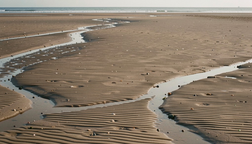
Britain has one of the largest tidal ranges in the world and almost every coastal picture in this journal depends on it. The tide decides whether there is sand or sea in front of the camera, whether a creek is a bright line or a grey groove, whether a reef breaks or drowns, and whether the walk back is available. Reading a tide table properly takes ten minutes to learn and removes most of the guesswork from coastal work.
The clock the tide runs on
Around most of the British coast the tide is semi diurnal: two highs and two lows a day, with roughly twelve hours and twenty five minutes between one high water and the next. That extra twenty five minutes is why high water is about fifty minutes later each day, and why a beach that worked beautifully at seven this morning is wrong by the end of the week.
The range varies on a fortnightly cycle. Spring tides, the largest, follow the new and full moon by a day or two; neap tides, the smallest, follow the first and last quarter. Springs give more uncovered ground at low water, faster currents and a shorter working window; neaps give less exposure, gentler movement and more time. Neither is better, but they suit different pictures, and a location scouted on a neap can be unrecognisable on a spring.
Ranges differ enormously by place. The Bristol Channel has the largest range in Britain by a wide margin, with a spring range at the head of it well over twelve metres, while parts of the south coast are far more modest and a few places have double high waters that do not follow the ordinary pattern at all. The number in the table is specific to the port at the top of the page and to nowhere else.
The rule of twelfths
A tide table gives you the times and heights of high and low water and nothing in between, but you usually need to know where the water will be in ninety minutes. The rule of twelfths is a good enough approximation for photography. Divide the range into twelve parts, and the water moves one twelfth in the first hour after high or low water, two twelfths in the second, three in the third, three in the fourth, two in the fifth and one in the sixth.
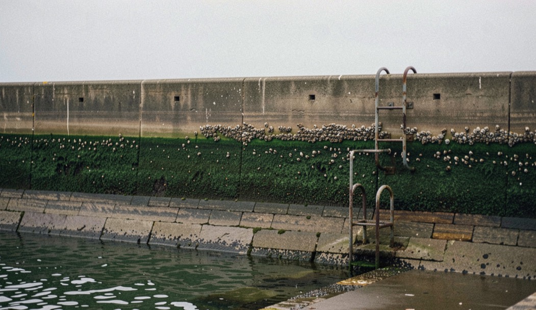
Two useful conclusions follow. Half the total movement happens in the middle two hours, which is when a beach changes fastest and when a rising tide is most likely to catch someone out. And the first and last hours are nearly static, which is why the hour around low water on a big spring is the safest time to be far out on flats, and why the hour around high water is the time to photograph anything that needs water up against a wall.
For working an estuary the third and fourth hour of the ebb is usually the productive window, because the channels are full and moving and the sand is still dark; that judgement is worked through in the entry on low water on the Solway.
On the ground
Work out the time of the tide turning and add a margin measured in hours, not minutes. On flat ground the water moves horizontally far faster than the height figures suggest, and on a marsh or an estuary it arrives from behind through the channels before it reaches the ground you are standing on, which is the hazard described in the entry from Blakeney.
Print the table or write the figures on your hand. A phone that has been out in salt spray for three hours is not a tide table, and the one place with no signal is always the one place where the crossing matters.
Datum, standard ports and secondary ports
Heights in a tide table are given above chart datum, which is set at or very near the lowest astronomical tide for that place. That is why the numbers are always positive and why they cannot be compared between ports without care: a two metre high water at one place may leave far more ground uncovered than a four metre high water at another.
Full tables are published for standard ports, of which there are a limited number around the coast. Everywhere else is a secondary port, listed with time and height differences to be applied to its standard port. Those differences matter: an hour of difference between the standard port and the beach you are on is enough to be genuinely dangerous on a rising tide, and even the free online services, including the official hydrographic office tidal predictions, are only as good as the port you selected in the box.
What the tables do not predict
Published tides are astronomical predictions. They assume average pressure and no wind, and the real sea does not oblige. Low atmospheric pressure lets the sea surface rise, at roughly a centimetre for every hectopascal below the standard of about a thousand and thirteen, so a deep depression at nine hundred and seventy can put the water thirty or forty centimetres above the predicted height before the wind has done anything at all.
Then the wind does something. A strong onshore wind piles water against the coast and holds it there, delaying the ebb and raising the high; an offshore wind does the reverse. Combine a big spring tide, a deep low and an onshore gale, which is the classic North Sea surge, and the water goes well beyond anything printed. The chart reading that warns you of that combination is covered in the note on synoptic charts.
Building a coastal plan from the two tables
A coastal session is the intersection of two timetables. One is the tide, which says when the ground exists. The other is the sun, which says when the light on it is any use. On a west facing coast in June those two coincide beautifully every couple of weeks and are hopeless in between; on an east facing coast the same arithmetic applies at the other end of the day.
The method is to start from the light, list the mornings or evenings in the next fortnight when the sun will be low over the ground you want, then look up the tide for each of them and cross off the ones where the water will be in the wrong place. What remains is usually two or three dates in a fortnight, which is a far more efficient way to work than driving to the coast and hoping.
Two other pages here depend directly on this arithmetic: the entry on saltmarsh at Blakeney, where the creeks only read on a rising tide, and the entry on groynes and harbour walls, where half tide on the ebb is the state that exposes the structure while the sand is still wet.