Light and Weather
Frost hollows, inversions and the Peak District valleys
Cold air pools in the bottom of a valley on a still clear night, and the cloud that forms there sits below the ridge line. The conditions that make it, and the ones that ruin it.
Published 21 February 2026 Hope Valley and Edale, Derbyshire Field entry
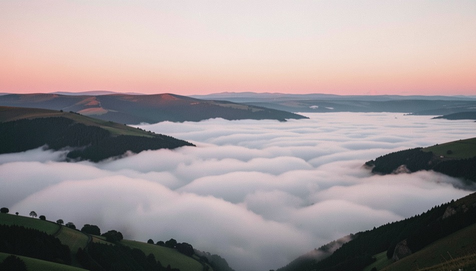
An inversion is simply the ordinary arrangement of the atmosphere turned upside down. Normally air gets colder with height; in an inversion there is a layer where it gets warmer with height instead, and the cold, damp air underneath is trapped. If that trapped air is moist enough it condenses into fog, and if the valley walls stand above the top of the fog you get the picture everyone wants: a white floor with dark summits standing out of it.
The five conditions, all of which are needed
The first is a clear sky overnight, because the ground has to radiate its heat away to space. Any significant cloud cover acts as a blanket and the whole mechanism stops before it starts.
The second is very light wind. Cold air is denser than warm air and it flows downhill of its own accord, gathering in the valley bottoms; a breeze of any strength mixes it back into the layer above and the pooling never happens. In practice anything over about five knots at ridge level is a problem.
The third is moisture in the low ground. Rain in the previous day or two, a river, wet fields, standing water: the air has to be close to saturation for the cooling to produce fog rather than just cold. A long dry spell gives you a hard frost in the valley and no cloud at all in it.
The fourth is a long night. The ground needs hours to lose its heat, which is why this is an autumn and winter phenomenon in Britain and why the best of it falls between October and February. The fifth is high pressure, which supplies the clear sky and the light wind and adds a subsidence inversion of its own from above, capping the whole thing.
Where it happens in the Peak District
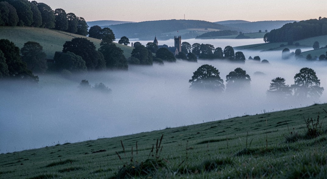
The White Peak and Dark Peak between them are unusually well set up for this. The Hope Valley runs east to west with steep ground on both sides and a river along the bottom, which is close to an ideal frost hollow; Edale, immediately to the north and enclosed on three sides, is another; the limestone dales to the south are narrower and fill more reliably but the walls are lower.
The viewpoints follow from the geometry. What you need is height above the fog top and enough distance to see along the valley rather than across it. Mam Tor and the ridge running east from it look straight down the Hope Valley and are the obvious choice; the gritstone edges east of the valley, Curbar and Baslow, look west across the lower ground with the sunrise behind the camera lighting the fog top directly.
The judgement call is how high to be. Too low and you are inside the fog, which is a completely different and much less rewarding picture. Too high and the fog top is a long way below, the summits standing out of it look small, and the scene turns into a plan view. The sweet spot is fifty to a hundred and fifty metres above the fog top, close enough that the individual features breaking through still have some size to them.
On the ground
The fog top is not fixed. It lifts and sinks through the morning as the sun starts to work on it, and a viewpoint that was above it at seven can be inside it by eight. Choose a position you can climb from rather than one you would have to descend from.
It is genuinely cold in these conditions and colder still because there is no wind to tell you so. Standing still on a gritstone edge from an hour before sunrise means gloves you can work the camera in and something to sit on, since the rock will take heat out of you faster than the air will.
Frost hollows, which are the same physics without the cloud
The classic British frost hollow is an enclosed basin where cold air collects and cannot escape, and the textbook example is at Rickmansworth in Hertfordshire, where an embanked railway across the valley traps the drainage and produces temperatures far below the surrounding area on still clear nights. The same thing happens at every scale, from a chalk combe to a walled field with a hedge across its lowest corner.
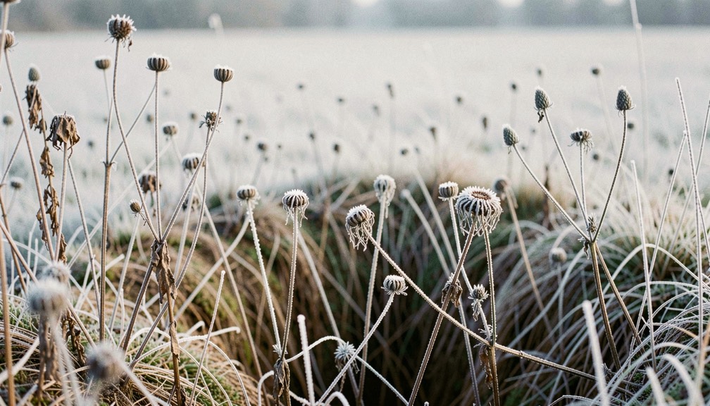
For a photographer these are worth knowing because they produce hoar frost when nowhere else has any. On a clear February morning the difference between a field at the top of a slope and the same field at the bottom can be the difference between damp grass and every blade outlined in ice. The subject is small, close and low: seed heads, fence wire, dead bracken, the edge of a puddle. It suits a long lens and the twenty minutes before the sun reaches the hollow, because the moment it does, the frost goes.
Getting the forecast right, and being wrong well
The check the night before is short. High pressure on the chart with slack isobars, clear skies forecast for the small hours, wind under five knots at height, and a dew point close to the forecast minimum temperature in the valley. That last comparison is the sharpest single indicator there is: if the overnight minimum is forecast to fall to the dew point, the air will saturate and fog will form. Reading the pressure chart itself is covered in the reference note on synoptic charts.
Even with all five conditions satisfied, a good proportion of attempts fail, usually because the fog forms too deep and swallows the viewpoint, or too thin and burns off before sunrise. That is the nature of it, and the sensible response is to have a second plan for the same walk. From the edges above the Hope Valley, a failed inversion is still a gritstone edge at sunrise; from higher ground it is the same walk described in the entry on getting onto the Kinder plateau before first light, which starts in the same valley.
If it is simply grey instead, that is a different opportunity rather than a lost one, and what to do with it is set out in the entry on anticyclonic gloom. The terms used through all of these entries, from inversion to gloaming, are collected in the glossary of British light.